


Crossing the Gotthard Pass on foot – part 1 of 3
How I made it across the Gotthard Pass on foot – preparation is key.

There are seven national routes. I chose number 7 to start with. More are likely to follow. Here’s an overview map of route 7. It starts in Basel and ends in Chiasso.
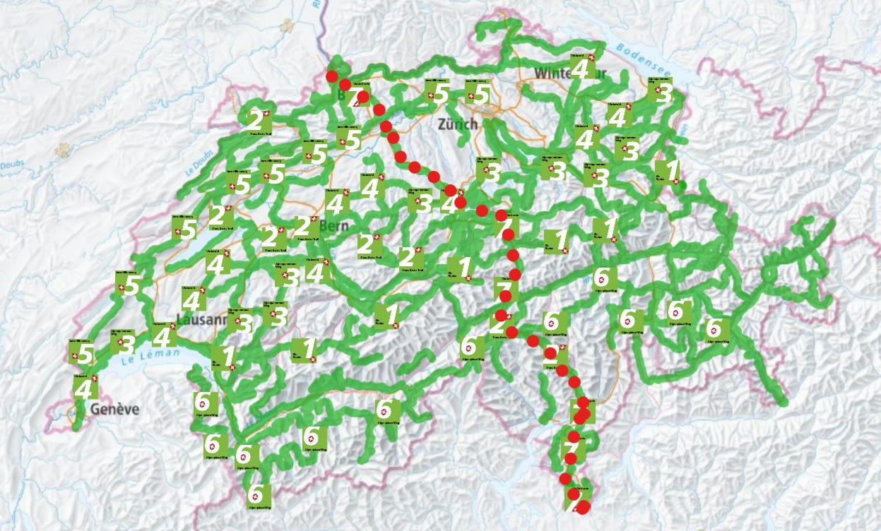
You can read more about the route and its stages here. I’m walking it in more stages than 20 that are described there. This has to do with my fitness level and with time available. Weather is also a consideration of course. Sometimes you can fit in a short hike before the weather changes.
The main route of the ViaGottardo followed the route from Basel over the Unteren Hauenstein and the Gotthardpass to Milan that was opened at the beginning of the 13th century. Its economic importance and ideological elevation as the lifeline of an independent Switzerland, make it an informative route on which to journey through the history and mythology of the country (Switzerland Mobility about Route 7)
Preparation
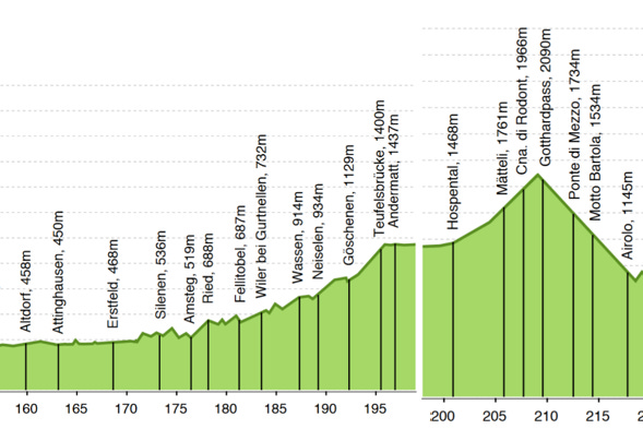
First there was physical preparation of course. I needed to know – or be reasonably sure - that I could do it. In the lead up to crossing the Gotthard Pass the route started climbing in Altdorf. For me the stage that clinched it and made me believe I could do it was when I hiked from Amsteg to Wassen. That took me approximately five hours (link video - the Relive app had a problem with the mountains but you still get an idea of what it was like) and there was a net elevation gain of 395 meters. From Hospental to the highest point of the route the elevation gain is 640 meters. Granted that’s a bit more than I’d done and it’s a lot steeper, but within reach. Remember when I said people should push against the boundaries of their comfort zone? This was me doing exactly that.
I kept an eye on the weather too - as much as planning is possible with regards to Alpine thunderstorms. And, after a couple of weeks with near constant rain, I picked days where the weather seemed reasonably stable – and it was.
Plan B
You always need a plan B. This can be stopping early and taking a bus, a train, a taxi, hitching a ride or even turning around. Also make sure you check bus/train schedules and opening hours for restaurants along the route. I first wanted to wait until the end of the month when buses would start running across the Gotthard Pass again. This would have given me the chance to hike up and down in two stages each (there are bus stops about halfway up and halfway down). I am now glad I didn’t wait. More on that in part 2.
Also, at the bus stop on the way up there is a restaurant. It was closed when I passed it. I had checked opening times and knew it was closed on Wednesdays, but if I hadn’t and had planned on stopping there for food that could have been tough. There’s literally nowhere else to go.
Preparation is key and yet …
I wasn’t really prepared for how grueling this climb would be. I had looked at a topographic map and thought I knew what to expect. The mental aspect of the hike can’t be found on any map though! I could see far ahead, and it just kept going up and up and up. The climb was relentless. Never letting up. No flat-ish sections to speak of. No breaks for your leg muscles. Some parts felt too steep to stop and my muscles were happier moving than trying to stand still. The wind was constant. The sun burning on my skin with no shelter or shade anywhere for the entire hike up.
Nowhere to hide.
Ideal plan vs. what I decided to do
Ideally, I would have spent two nights in a hotel in Hospental, only hiked up with what I needed for the day and taken the bus back down after. My body could have adapted to the higher altitude, and I could have set off early in the morning. Then the next day I’d have taken the bus back up to the Gotthard Pass and hiked down to Airolo. If I’d run into problems on either route, I would have had the option of hopping on a bus halfway.
The Gotthard Pass is only accessible in summer. Road opening times vary from year to year, depending on weather conditions. While cars can drive across the pass whenever it’s open, the buses only run from June 24 to October 8 (dates for 2023). Postauto offers a schedule search based on bus stops. That’s probably the easiest way to find out when buses run across the Gotthard Pass.
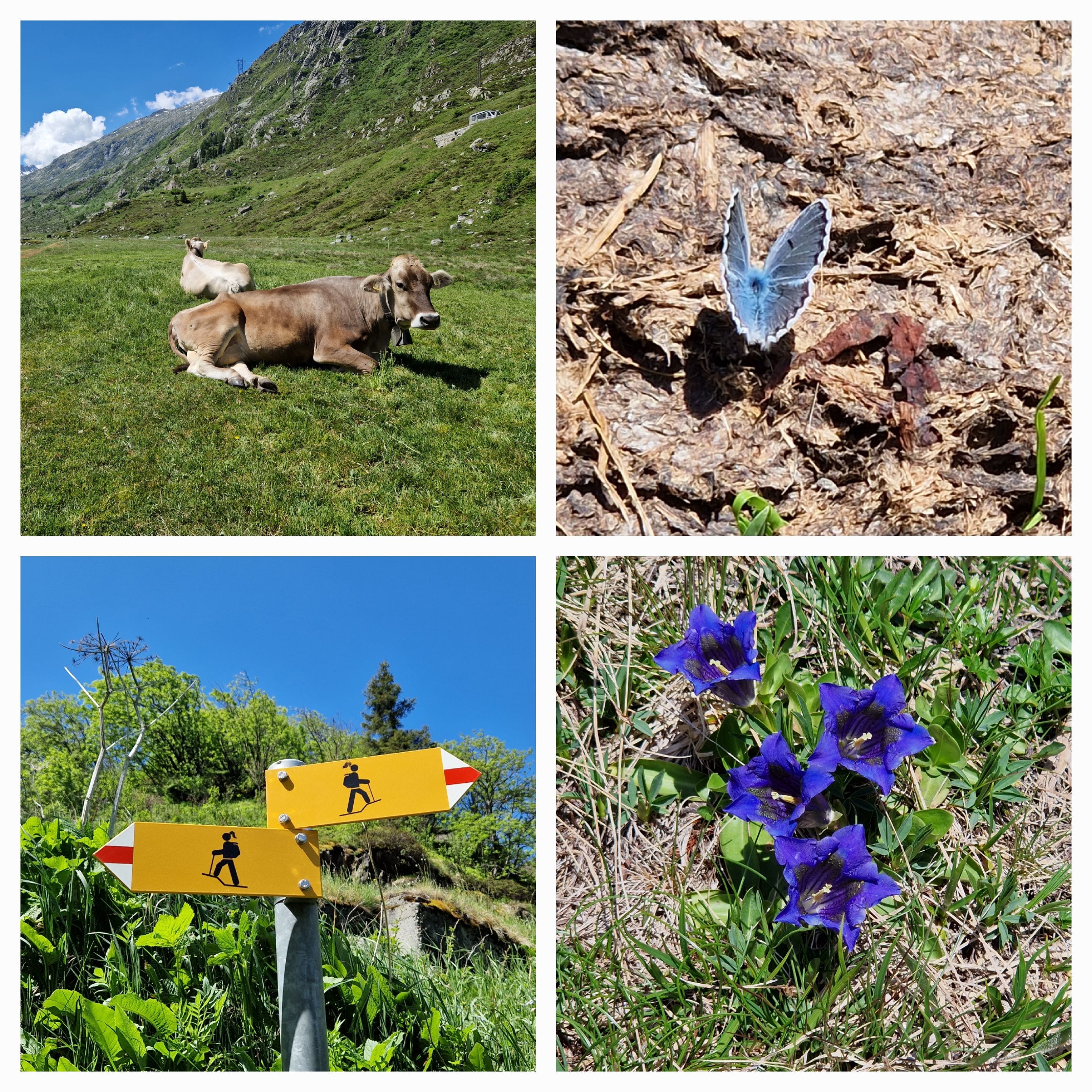
Somehow, I just had to do it without this safety net. So, I did. I booked a hotel on the pass and took the train to Hospental in the morning. I arrived at 10:41 and figured it would take me about five hours to get there. I took a picture of the Gotthard Pass sign at 16:02. Close enough to my 5-hour guess. And yes, the time indicated for that hike is 3h 10. I’m very happy for everybody who can walk it that quickly, but are those people seeing all the flowers? Talking to all the cows? Taking butterfly-on-cowpat pictures? Spotting hiking route signs that are just that little bit different?
To be continued …
Loved the “relive” video and random photos along the way. Be careful abandoning that safety net! Must have been very rewarding to achieve. Looking forward to part 2! Keep exercising to increase/ maintain strength. Appears you will need it. Congratulations on this segment! 😊🚶♀️🚶♀️🚶♀️